
August 23, 2025: In a significant move to enhance highway safety and disaster management, India is deploying advanced artificial intelligence (AI) and machine learning (ML) systems to monitor landslides and flooding in vulnerable regions. The initiative, driven by government agencies in partnership with leading technology firms and research institutes, aims to provide timely and accurate warnings, surpassing the capabilities of traditional monitoring methods.
Under the guidance of the Ministry of Road Transport and Highways (MoRTH), several pilot projects are integrating AI-based monitoring systems into national highways. These systems leverage a combination of real-time sensor data, satellite imagery, and environmental information to predict hazards with higher precision. According to officials, the technology will not only enhance safety for motorists but also enable faster response from disaster management authorities.
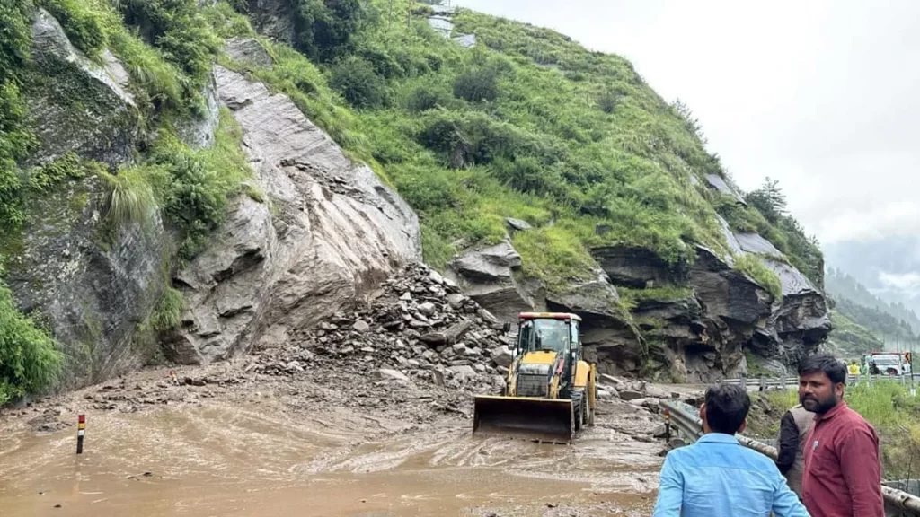
In Himachal Pradesh, where rainfall-induced landslides have historically caused extensive damage, the Geological Survey of India (GSI) has developed an AI-driven early warning system. The system continuously analyzes rainfall patterns, soil moisture, and topographical data to forecast potential landslide events. Authorities stated that these forecasts can facilitate timely evacuation measures and prevent loss of life.
Similarly, Kerala’s Idukki district has launched the IDRIS system, a comprehensive AI-powered platform designed to predict landslides, floods, and forest fires. Local administration officials hailed the initiative as a step toward making Idukki India’s most disaster-resilient hill district.
Experts explain that AI and ML models, including deep neural networks and support vector machines, are central to these projects. By processing large volumes of satellite images and sensor data, the systems can identify subtle environmental patterns that precede hazardous events. The National Remote Sensing Centre (NRSC) of ISRO has also contributed to this effort, providing satellite imagery that helps assess the aftermath of floods and identify vulnerable areas.
Tamil Nadu’s Nilgiris district has emerged as a key beneficiary of these innovations. As one of the first regions in India to receive operational landslide forecast bulletins during the 2025 southwest monsoon, Nilgiris demonstrates how predictive modeling can inform local authorities and communities about imminent risks. The bulletins are part of the LANDSLIP project, a collaborative effort by GSI to implement regional landslide early warning systems.
Government officials emphasized that these AI-driven initiatives are part of a broader strategy to modernize India’s disaster management infrastructure. “By combining technology with timely decision-making, we aim to reduce the human and economic toll of natural disasters,” a senior MoRTH official stated.
As India continues to face the twin challenges of heavy rainfall and hilly terrain, experts say that integrating AI into disaster management can transform preparedness and response measures. With expanding deployments across multiple states, authorities hope to achieve more accurate forecasting, faster warnings, and enhanced safety for millions of people living in landslide- and flood-prone areas.