The southwest monsoon has well and truly taken hold of India this season, and it’s not holding back. As of the latest weather bulletins, the India Meteorological Department (IMD) confirms the monsoon has pushed further into Madhya Pradesh, the remaining parts of Chhattisgarh, Jharkhand, and Bihar, large portions of Uttar Pradesh, most of Uttarakhand, and parts of Himachal Pradesh and Ladakh. In simple terms, the rain belt is now covering nearly the entire country, and several states are bracing for what could be a wet, eventful few weeks ahead.
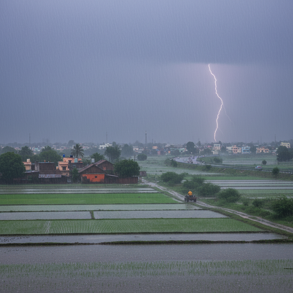
If you’ve been tracking India weather today, you’ve probably noticed the pattern: heavy showers in one region, thunderstorms and gusty winds in another, and humid, sticky conditions almost everywhere else. This isn’t unusual for the season, but the intensity this year has prompted IMD to issue a fresh round of heavy rainfall alerts, urging people in vulnerable zones to stay cautious.
Where the Rain Is Hitting Hardest
Some pockets of the country are seeing particularly aggressive rainfall. Sub-Himalayan West Bengal and Sikkim have been flagged for isolated heavy to very heavy rainfall, with extremely heavy spells possible in the coming days. Kerala is also under watch with very heavy rainfall expected to pick up soon. Northeast India including Arunachal Pradesh, Assam and Meghalaya is also under watch.
Meanwhile, central India isn’t being spared either. Vidarbha, Chhattisgarh, and parts of Madhya Pradesh are looking at a mix of thunderstorms, lightning, and gusty winds reaching speeds of 40 to 60 kmph, occasionally gusting even higher. In the hill states of Himachal Pradesh and Uttarakhand, isolated heavy rainfall combined with thunderstorm activity is expected to keep things unpredictable for residents and travelers alike.
Cities like Varanasi, Mirzapur, and Ayodhya in eastern Uttar Pradesh have already recorded substantial rainfall in a single 24-hour window, some crossing the 40 cm mark, according to IMD’s latest data. That’s a strong signal of just how active this year’s monsoon system has become.
The IMD Weather Alert System Explained
For anyone unfamiliar with how IMD weather alerts work, the department uses a simple color-coded system: yellow for “watch and stay updated,” orange for “be prepared,” and red for “take action.” Orange and red warnings typically call for real precautions, things like avoiding waterlogged underpasses, staying off flooded roads, and keeping an eye on local administration updates. Urban and hilly areas are generally the most vulnerable, since cities often struggle with drainage during sudden downpours, while hill regions face landslide risks when the ground gets oversaturated.
IMD has also pointed out something worth remembering: the further out a forecast looks, the less precise it becomes. So while a five-day outlook gives a general sense of what’s coming, the real specifics tend to firm up only a day or two in advance. That’s why staying tuned to daily updates matters more than relying on a single forecast from earlier in the week.
A Silver Lining for Farmers
It’s not all about disruption, though. For India’s agricultural sector, this monsoon intensity is largely good news. Kharif crops like rice, soybean, cotton and pulses are heavily dependent on timely and adequate rainfall and this year’s pattern looks promising for sowing across much of the country. Agricultural experts monitoring the season say that if the rains remain consistent without extreme flooding, farmers could reap healthy yields later this year. That said, there’s a caution here too: too much rain too quickly, especially during transplanting season, can actually hurt young rice crops rather than help them.
What Residents Should Keep in Mind
If you live in one of the flagged regions, the advice from authorities is fairly consistent: avoid unnecessary travel during heavy spells, steer clear of low-lying areas prone to waterlogging, and don’t underestimate gusty winds, since falling tree branches and structural damage are real risks during thunderstorm activity. In the cities, commuters should expect disruptions on public transport, especially during the peak hours of heavy rain.
For those requiring real-time information on a location-specific basis, IMD’s district-wise warning system and daily national weather bulletins are the most reliable source. Monsoons can turn quickly, so the smart play right now is to check for updates daily, rather than relying on last week’s forecast.
The Big Picture All in all, this monsoon season is shaping up to be active and intense in some areas.
While the rain is a welcome relief from the intense heat in places like Uttar Pradesh and Odisha, it also means that everyone, whether you’re a city commuter, a hill-state resident or a farmer watching the skies for your kharif crop, needs to be a little more careful. With the season underway, staying abreast of official IMD updates will be key to navigating the risks and opportunities that this monsoon brings.
Heavy Monsoon Rains Intensify Across India: What You Need to Know Today.