
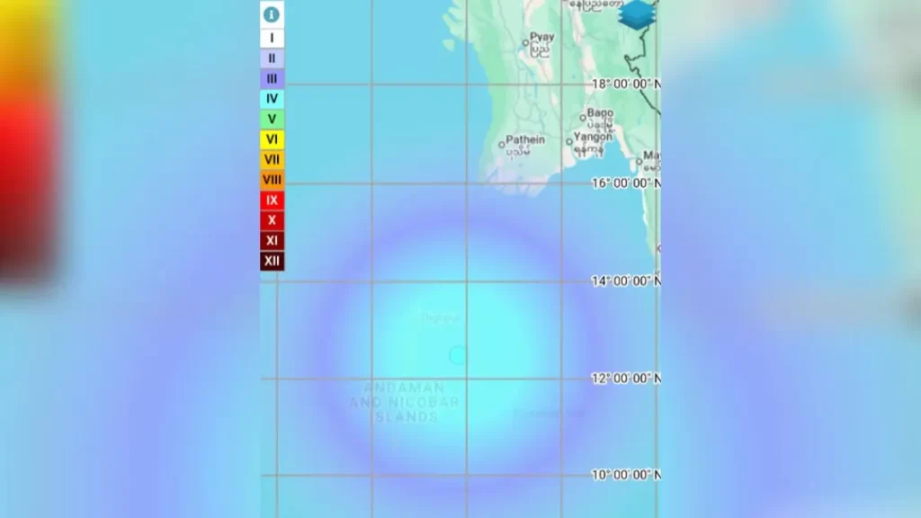
A moderate earthquake measuring 5.4 on the Richter scale struck beneath the waters of the Andaman Sea near the Andaman and Nicobar Islands on Sunday, November 9, 2025, at around 12:06 p.m. IST, according to the National Centre for Seismology (NCS). The tremor was recorded at a depth of approximately 90 kilometres, and authorities confirmed that there were no immediate reports of casualties or property damage.
Seismological data revealed that the epicentre of the quake was located at approximately latitude 12.49° N and longitude 93.83° E. While the NCS measured the earthquake at a magnitude of 5.4, some international monitoring agencies, such as the German Research Centre for Geosciences (GFZ), reported a slightly higher magnitude of 6.07 and a shallower depth of about 10 kilometres. Despite the discrepancy in readings, both agencies agreed that the event was of moderate intensity and unlikely to cause significant structural damage.
The Andaman and Nicobar Islands lie within one of the most seismically active regions of the world, along the boundary between the Indian Plate and the Burma (Myanmar) Plate. This zone forms part of the broader Alpine-Himalayan seismic belt, known for frequent tectonic activity. Moderate earthquakes are common in this area due to the ongoing subduction of the Indian Plate beneath the Burma microplate. In recent weeks, the region has experienced a series of low- to mid-intensity tremors, ranging from magnitudes 4.3 to 5.4, though none have resulted in major damage or casualties.
Following the tremor, local authorities activated standard monitoring protocols and advised fishermen and tourists in coastal zones to remain cautious. Disaster management teams have been put on alert, and officials continue to monitor for possible aftershocks. The Malaysian Meteorological Department also confirmed that the event did not pose any tsunami threat to the surrounding coastal regions, offering reassurance to residents and neighbouring countries.
Experts noted that while a magnitude 5.4 earthquake is categorized as moderate, the depth of the quake and local geological conditions play a significant role in determining the intensity of ground shaking. In this case, the relatively deep hypocentre, around 90 kilometres below the surface, likely reduced the level of shaking experienced by people on land. Variations in reported magnitude are common in the immediate aftermath of such seismic events, as agencies use different equipment and models to assess the tremor’s strength.
For India’s disaster management authorities, this incident serves as a reminder of the continuing need for preparedness in the country’s coastal and island regions. The lack of reported damage may reflect improved adherence to modern building codes and better public awareness of earthquake safety. However, experts caution that the recurring pattern of tremors in the Andaman region highlights the importance of maintaining robust early-warning systems and ensuring local communities remain informed and vigilant.
Although the November 9 earthquake did not cause any significant impact, it underscores the persistent seismic vulnerability of the Andaman and Nicobar Islands. Situated along an active tectonic boundary, the area will continue to face potential seismic risks. Authorities are expected to continue close monitoring over the coming days to determine whether this event was an isolated occurrence or part of a broader sequence of tectonic activity in the region.